
blah blah blah
South and North Moat Mountains
Length: 10.4 miles out-and-backDifficulty (click for info): Very Hard
Elevation Gain: 3250 feet
Rating (click for info): 10/10
Elevation: 2770 ft (South) and 3198 ft (North)
Prominence: 80 ft (South) and 1176 ft (North)
Driving Directions:
Trailhead and parking area are on Passaconaway Road in Albany, NH (Middle and North Moat are in Bartlett). From the junction of Rt. 153 and Rt. 113 in Conway, go north on Washington Street. In 0.2 miles, bear left onto West Side Road. Continue 0.7 miles, then turn left onto Passaconaway Road. The parking area is 3.2 miles down the road, on the right.
About the Hike:
Moat Mountain is the dominant mountain mass west of North Conway. It is the easternmost mountain on the main ridgeline of the Moat Range. Moat itself is a long north-south running ridge, with many peaks along the crest and many more spurs extending in all directions, including many of the cliffs above the far east end of the Kancamagus Highway. The three most significant peaks on the main ridge are designated as North, Middle, and South Moat Mountain and are all crossed by the Moat Mountain Trail. These three all have open rocky summits with spectacular 360-degree panoramas. North Moat has the best view, but is the most difficult to access, since you must deal with the tedious undulations of the Moat ridgecrest. To see the hike to South Moat alone, see South Moat Mountain. You can also climb North Moat alone via the northern Moat Mountain Trail and Red Ridge Trail loop.
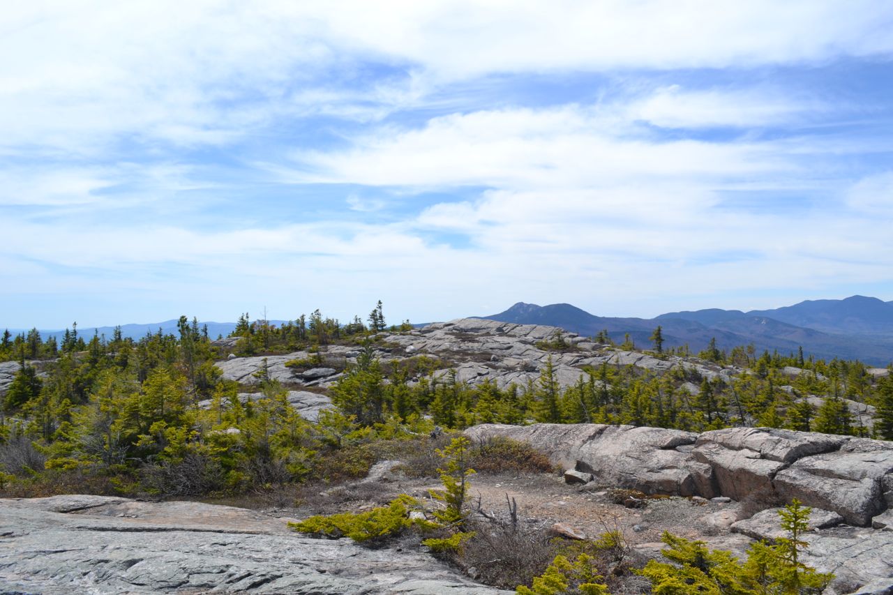
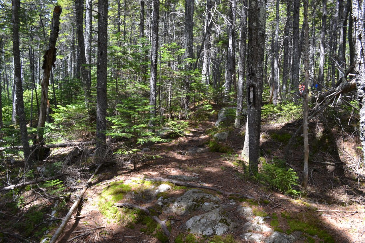
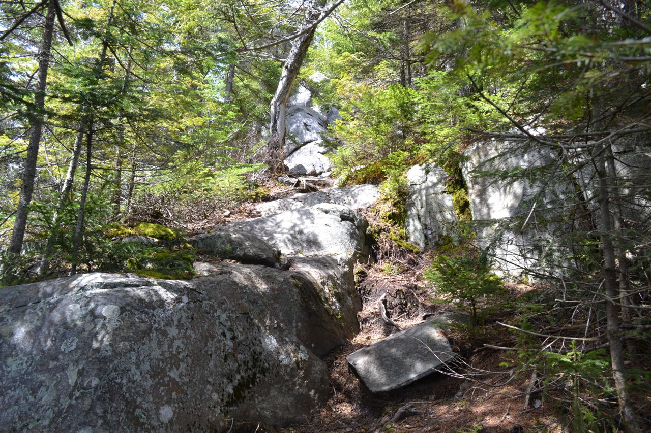
The trail starts in an area of recent logging. The beginning of the trail has been relocated to avoid the logging landings. Leaving the far left corner of the parking area (rather than up the gated logging road), the trail winds through the forest near a logged clearing. It climbs around a small hill and descends to cross a brook, then switchbacks steeply up the other side, soon crossing an older logging road. Swinging around the hillside, the trail traverses across the slope, high above Dry Brook. At one mile, the trail descends to cross this brook on a wooden bridge. After a few short climbs and flat areas, the trail steepens and becomes rocky, soon entering forested ledges. It climbs moderately for a while before turning a corner to begin the steepest part of the trail. Several difficult and very rocky pitches lead to the first of the open ledges, 0.9 miles from the brook. Here, there is a good view south to the Ossipees and southwest to Mt. Chocorua. The trail now ascends mostly over open rock, with a few sections through the woods. Blazes may be difficult to follow on the ledges. The ledges may be occasionally slippery. It continues upward, with increasing views, first limited views to the southeast, then more open views to the east, south, and west. The trail steepens near the top and the views culminate in the amazing panorama from South Moat's summit.
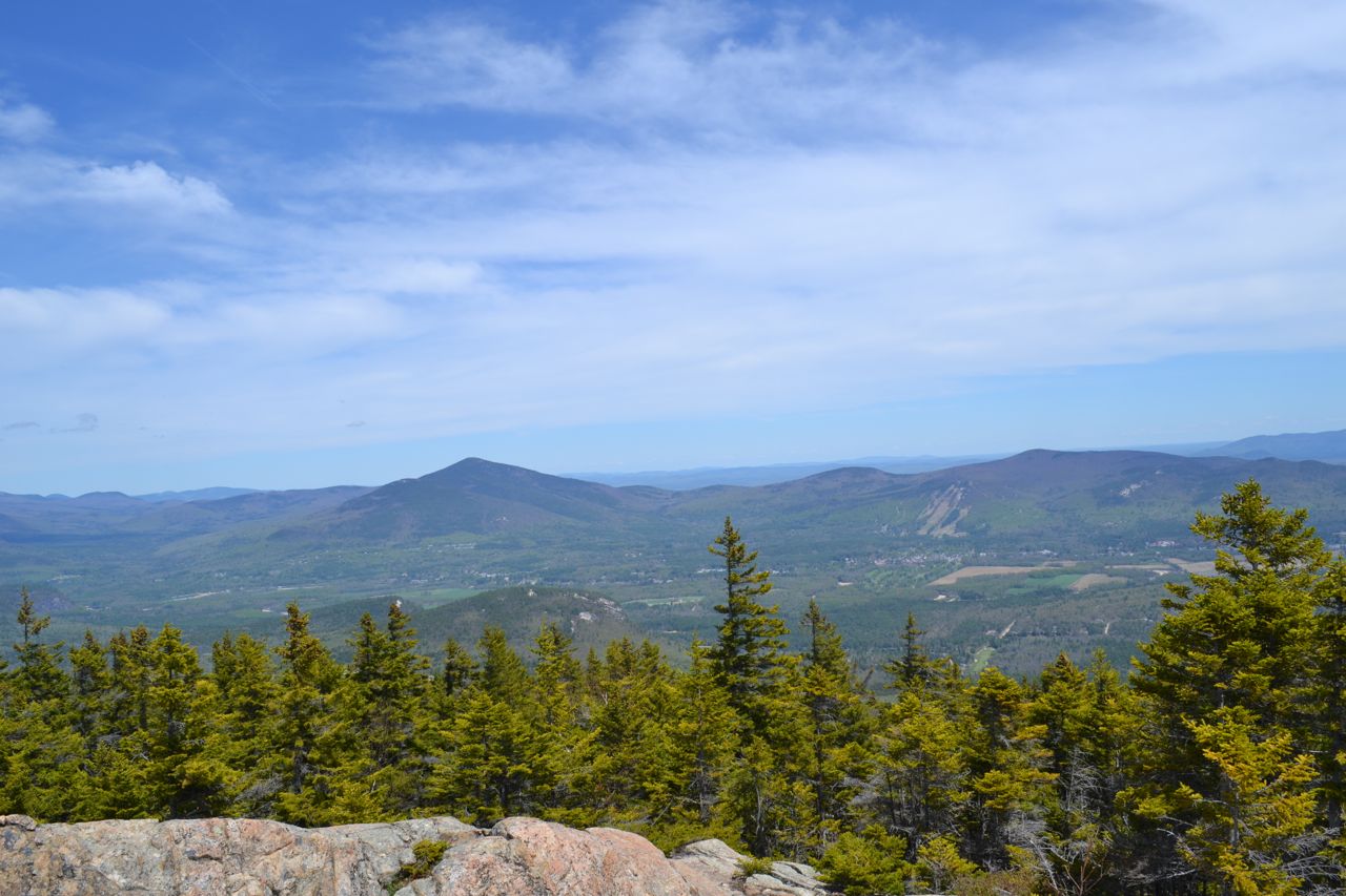
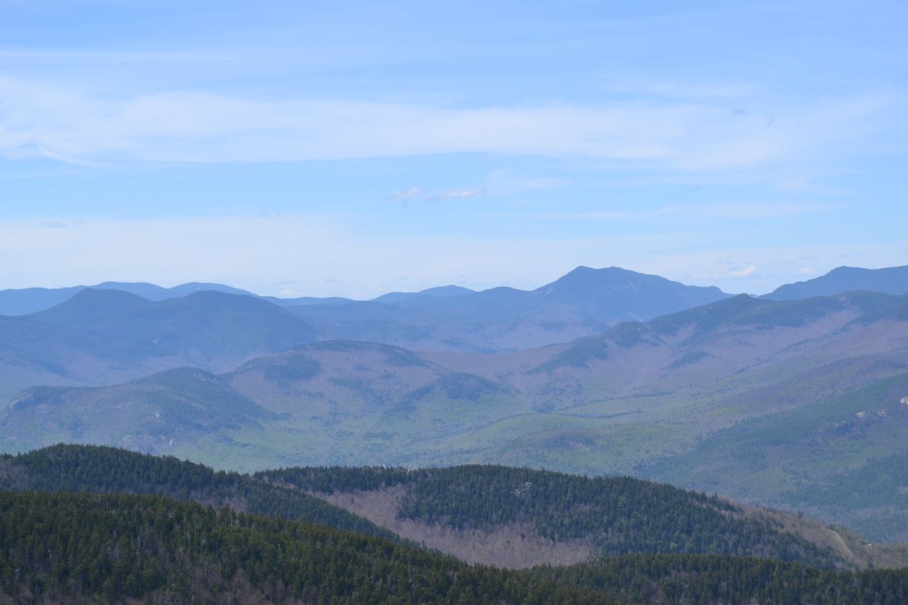
The views from the Moat Mountains are among the best in the region. To the west, you look out over the Sandwich Range and the valley of the Kancamagus Highway. To the northwest, over the rest of the Moat Range, you look into the center of the White Mountains. To the north are Middle and North Moat. Just to the right of North Moat is the Presidential Range, with the Carter-Moriah Range to the right of that. To the east are the Baldface Range, Mt. Kearsarge North, and the Green Hills, with the flat expanse of western Maine beyond. To the south, the view extends far into southern New Hampshire. From South Moat, the trail descends off the open summit and travels over ledges, then dips back down into the forest. It quickly rises onto the rock again and meanders over the broad summit area of Middle Moat Mountain with views in all directions, including back to South Moat. The trail climbs down the expansive ledge area othe north side of Middle Moat, crossing the summit at 0.6 miles from South Moat, then enters the forest and descends moderately to the lowest col on the ridge. The trail in this section is far less used than the other parts. After a while, it begins to climb, first easily, then more steeply to the summit of Red Ridge (one mile past Middle Moat), where it passes the Red Ridge Trail on the right. Good views are found by climbing atop the sharp summit rocks. The trail, now well-travelled, descends from Red Ridge and begins a long, steep climb to North Moat. You must negotiate several difficult rock scrambles in the forest before ascending to a knob just before the summit of North Moat. A slight descent and one more climb lead to the open summit. Now at the highpoint of the ridge, the view to the north is no longer blocked as it was on South Moat, so in addition to the mountains visible from South Moat, you can also see the Willey Range, Crawford Notch, and the southern Presidentials and Montalban Ridge.
Printable directions page